Maleny Walks and Trails
Maleny Walks range from short, picturesque trails near the town centre, to the 55 Kilometre Sunshine Coast Hinterland great walk.
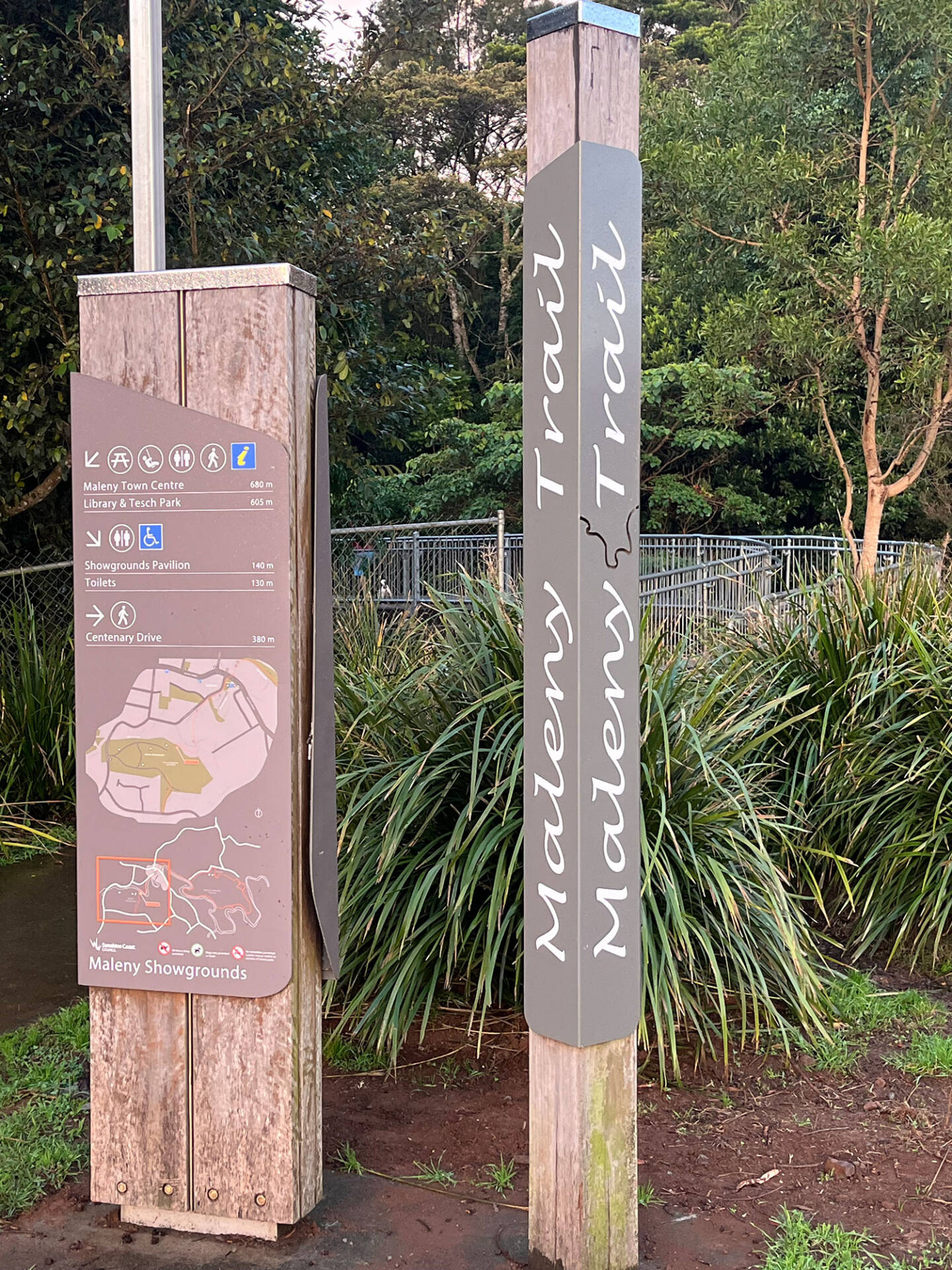
The first three walks are in and around the town, with the starting point easily reached on foot from Maple Street.
Numbers 4-10 are out of town and you will need to drive to the stepping off points.
With so much to cover, this article is a little long, but you can go directly to information about each of the Maleny walks by clicking on the links to the right.
If you are looking for a gentle, picturesque stroll numbers 1, 4, 5 and 6 are best.
If you like bush walks try 5, 6, 9 and for the the real enthusiasts we have thrown in 10 as a serious challenge.
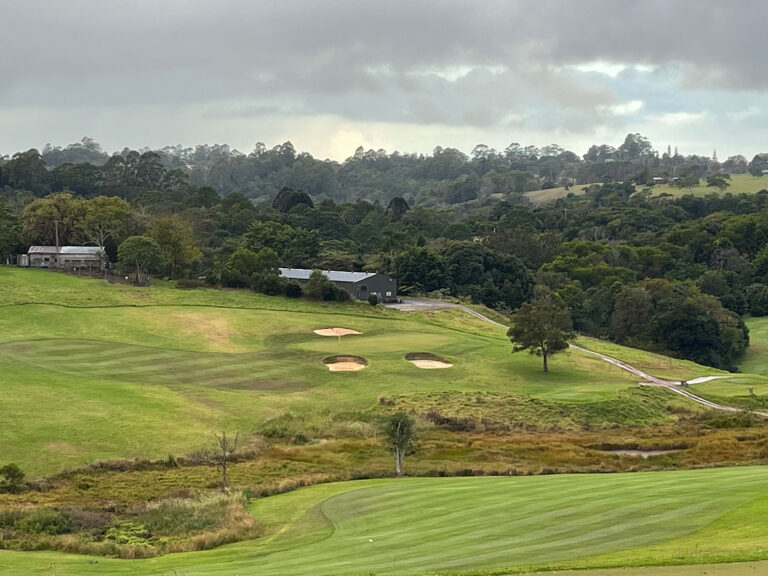
For a real sense of Maleny Township, there are two circuits. #2 circles the township, while #3 takes a picturesque path beside the Obi Obi creek, and golf course.
Our 10 Favourite Maleny Walks
- Obi Obi Boardwalk 1.7 Km
- Maleny Hills City Walk 4.2 Km
- The Maleny Trail 7.6 KM
- Gardners Falls walk 600 Mtrs
- Mary Cairncross Reserve Walk <2 Kms
- The Baroon Lookout Trail 4.4 Kms
- Kondalilla Falls Walks
- The Picnic Creek circuit 2.4 Kms
- The Kondalilla Falls Circuit 4.8 Kms
- Sunshine Coast Hinterland Great Walk 55 Km
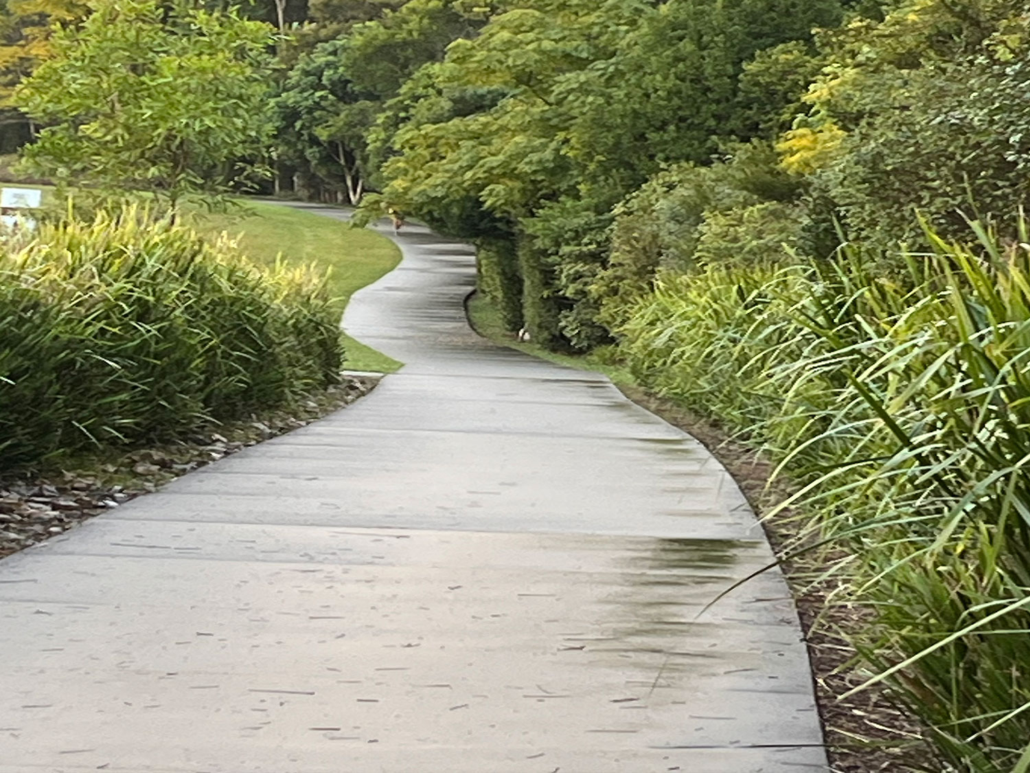
The Obi Obi Boardwalk
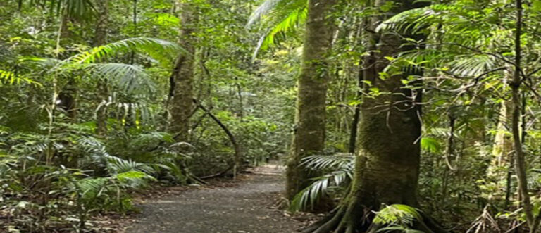
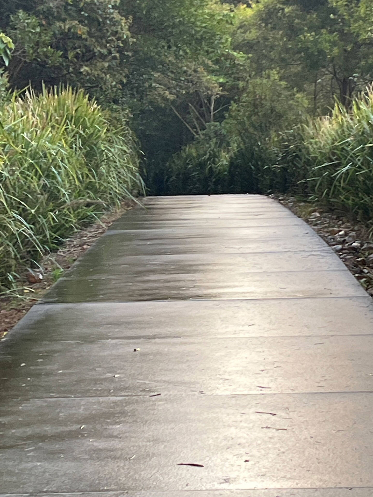
This is a gentle 850 metre stroll (1.7 Km return) beside the Obi Obi creek. The pathway is a combination of raised boardwalk and paved pathway. The path follows the creek, and through an area of regenerating, sub-tropical Rainforest.
The rehabilitation project was started in 1996 and is a long term project by Barung Landcare.
There are a number of viewing locations where you might spot a Platypus, particularly early in the morning or late afternoon.
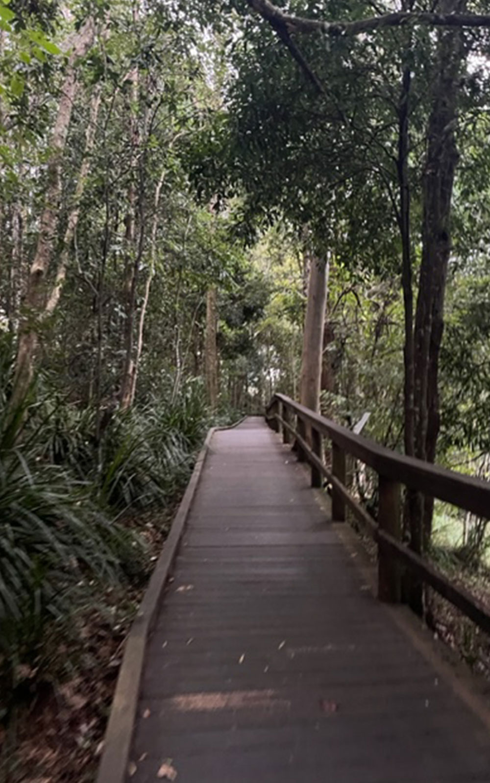
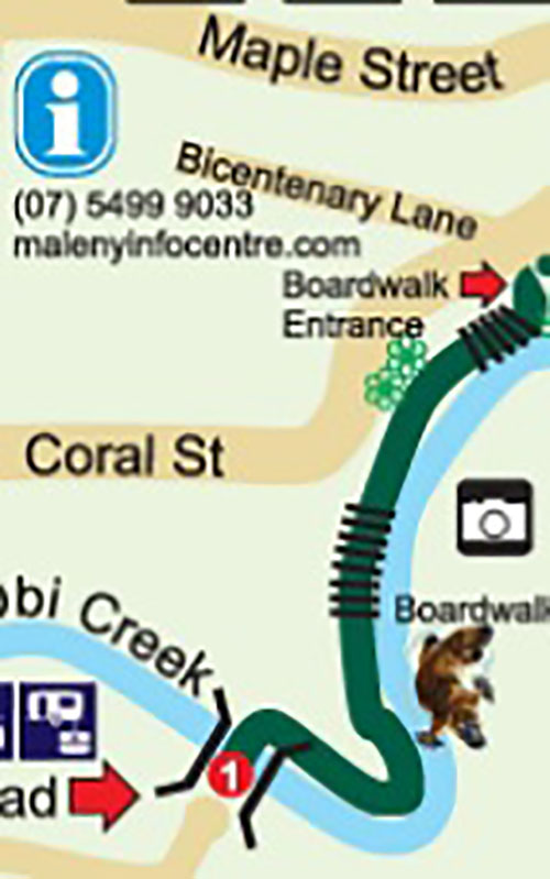
You enter the boardwalk from Coral Street, (opposite Bicentenary Lane) and follow the path to the Maleny showgrounds before retracing your steps. Suitable for wheelchairs and Strollers
Maleny Hills City Walk
This 4.2 kilometre route uses the roadways and footpaths to circumnavigate the Town in just over an hour.
If you have a car, park at the rear of the Riverside centre (off the roundabout at the bottom of town). Take the short stroll on the Boardwalk along the Obi Obi creek to the main street, before crossing over onto Coral Street. Follow Coral Street to the Corner of Bicentenary Lane and Turn left onto the Obi Obi boardwalk.
Follow the boardwalk and paved pathway alongside the creek, and through the regenerating rain forest, to the Maleny showgrounds. Turn right and head west across the Showgrounds until you reach, and carefully cross Maleny-Stanley River road.
About a hundred metres to the right, take the footbridge on your left across the Obi Obi creek and up onto Cedargrove Court. At the top the hill veer left on Cedar Street before turning left again alongside Macadamia Drive.
This completes the Southern circuit.
Cross Macadamia Drive onto Bean street. You will pass the Soldiers Memorial Hospital, and perhaps spend a few minutes of reflection in the Walk of Remembrance.
Then, resume the loop along Bean and Tamarind Streets, before turning right onto Teak Street for the final stage back down into town, to complete the Northern Circuit.
Both the climb up Cedargrove Court, and down Teak street are quite steep making this walk unsuitable for wheelchairs or young children.
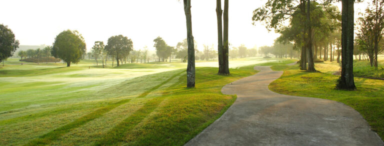
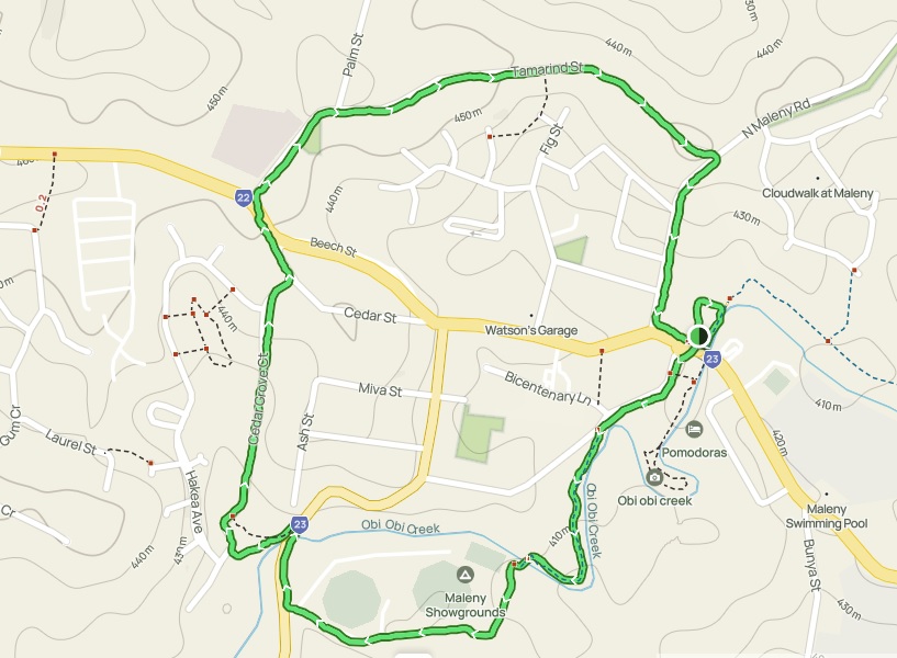
The Maleny Trail walk
This is a 6.7 kilometre trail starting at the Trail Head in the Maleny Showgrounds.
If you drive to the starting point, avoid frustration with parking, by driving into the Showgrounds. At the entry, take the left fork through the Caravan park area to the car park at the end of the road.
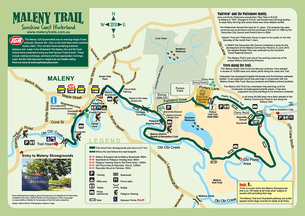
From there, simply cross the footbridge onto the Obi Obi Boardwalk to begin.
Follow the “boardwalk” into town, past the Library, and across Bunya Street, before rejoining the Boardwalk alongside the Riverside Centre. The path is well signed and in excellent condition.

Follow the Obi Obi creek, pausing at the various viewing platforms where you might be lucky enough to see a resident Platypus. Take a stroll onto Cloud Walk Pathway before returning to the main trail to enjoy the “Peace in the Trees” sculptures and loop around the Golf Course.

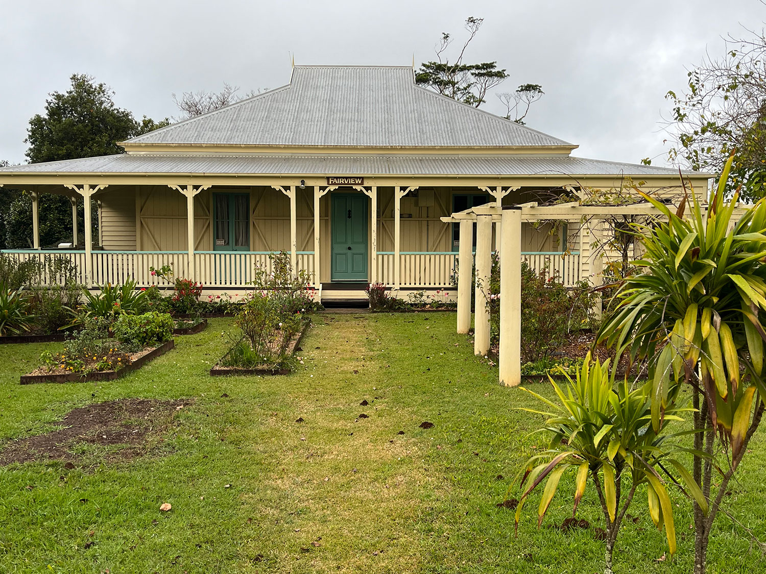
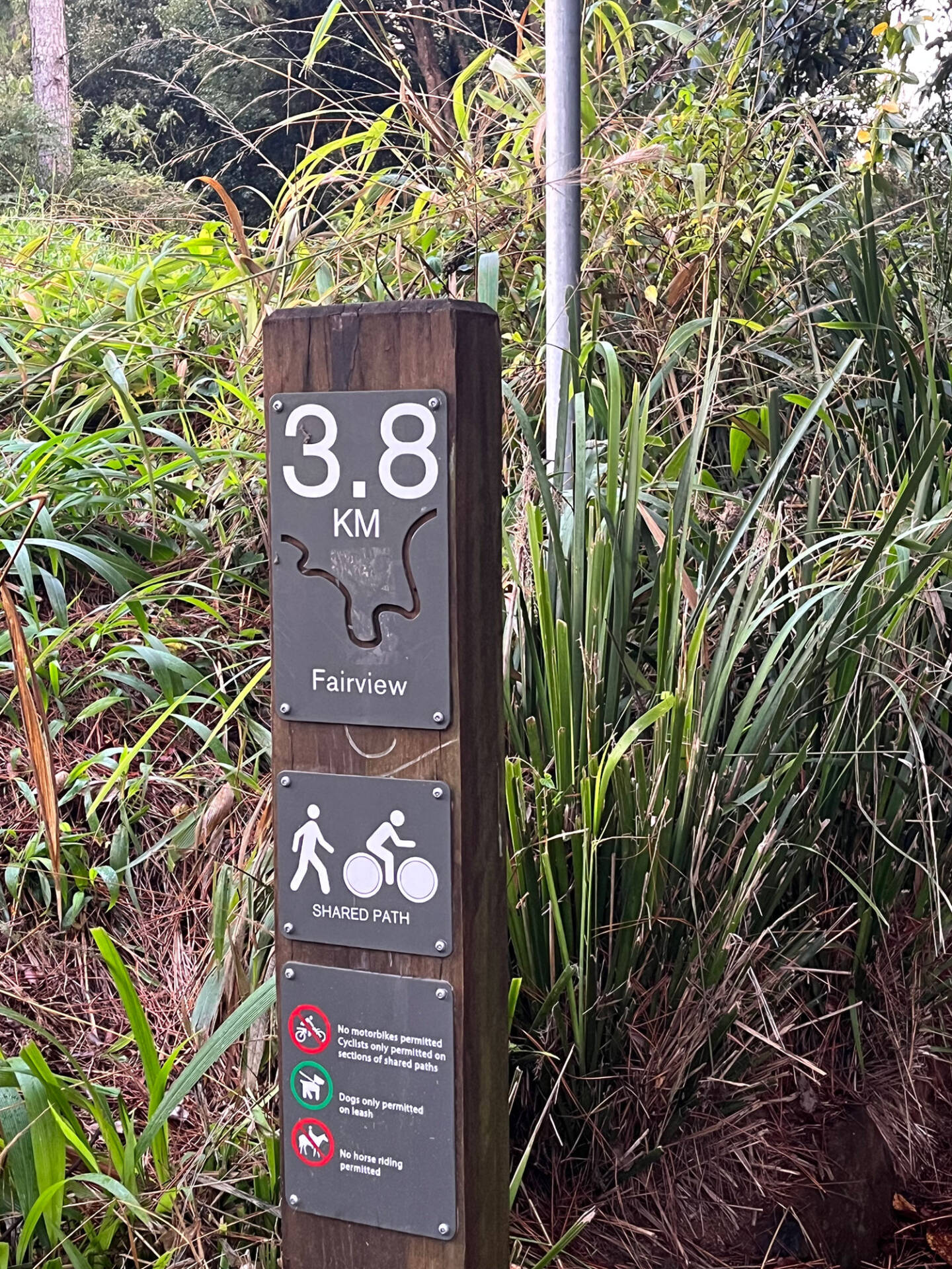
Be inspired by the “Poetry Sculpture Trail, as you head towards historic Fairview Pattemore House, and on along Parkland drive which takes you back to the main trail to head into Town. Alternatively, retrace your steps back past Riverside and the Library to the Showgrounds carpark.
There are many places to pause and take in the scenery, as well as picnic and BBQ spots, Platypus viewing areas, toilet facilities and regular seating if you simply need to take a break.
This map does show a “proposed” footbridge linking with the path to Gardners Falls but currently there is no access to the Falls from this Maleny Trail.
Gardners Falls walk.
Drive 5 kilometres east of town on the main road, and turn left onto Obi Obi Lane South.
At the end you will find a carpark and the entrance to the Gardners Falls walk. This is the shortest of the Maleny walks, only 300 metres and takes around 15 minutes there and back.
The path follows Obi Obi creek to the Falls. It is a popular spot with visitors all year around, but particularly in the warmer months.

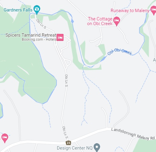
The path is paved most of the way but not suitable for wheelchairs as you near the falls and swimming holes. Please read our article on Gardners Falls here.
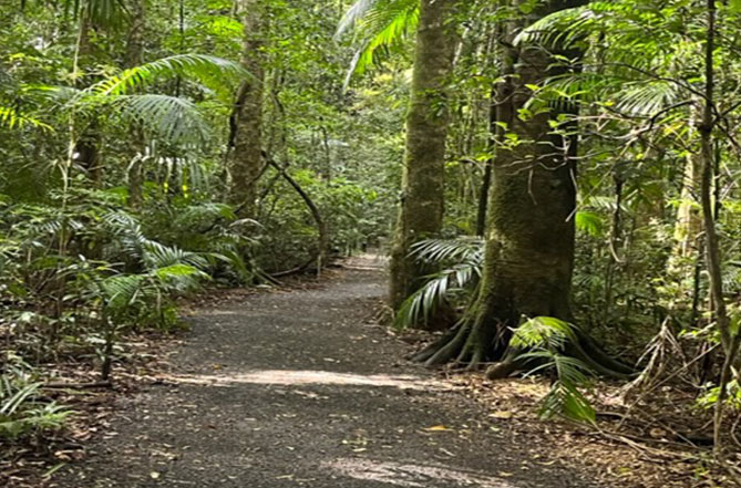
Mary Cairncross Reserve walk
Drive to Mary Cairncross reserve on Mountainview Road.
This is possibly the prettiest of Maleny walks.
Entry to the walk is via the Rain Forrest Discovery centre, where a gold coin donation for entry is appreciated.
This walk is mostly flat, on well-constructed walkways, and loops through some of the best remnant sub-tropical rainforest in the Country.
It is more of a stroll than a walk as you enjoy the Pademelons, Flying Foxes and a series of spectacular, sign posted, native trees.
You are free to enjoy the reserve alone, but we learned much more with the help of a guide.
For a full appreciation of this walk please read about our guided tour of the Mary Cairncross Reserve.

A little further afield near Montville are the Baroon Lookout Trail and Kondalilla falls walk.
The Baroon Lookout Trail
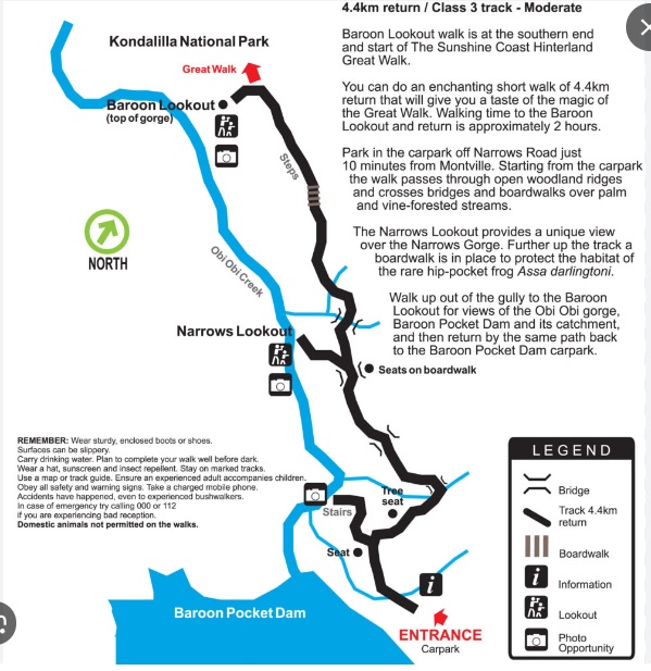
Take the Montville-Maleny road to Montville and as you enter the town turn left onto Western avenue. Continue for 3 kilometres and turn left onto Narrows road. After a steep decent drive for 3-4 kilometres until you see the entrance to “The Great Walk” on your right.
Don’t be concerned by signage, whilst the Great walk is 55 Kilometres long, the Baroon Lookout trail is only 4.4 kilometres return. It will take about two hours to complete at a leisurely pace, but is enough to give you a sense of the majesty of the Great Walk.
Follow the trails, boardwalks and bridges, stopping at The Narrows Lookout, for a unique view of The Narrows Gorge. From there continue up to the Baroon Lookout to enjoy views over the Baron Pocket Dam, the Obi Obi Gorge and Lake Baroon Catchment. Then, when you are ready to leave simply retrace your steps back to the carpark.
There are no facilities on this walk, so take everything you might need with you, including drinking water. This is a high rainfall area, and even on a dry day surfaces in the area may be slippery so wear suitable footwear and pay close attention to your surroundings.
Kondalilla falls walks
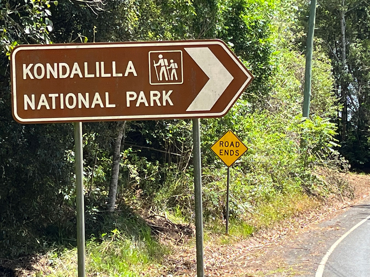
After passing through Montville, 2 kilometres out on your left is the Kondalilla Falls Road.
There is ample parking and amenities available before starting the decent to the Falls, but nothing further down.
There are two walks here. Both are steep, and involve stairs.
The Picnic Creek circuit.
This is only a 2.4 km round trip to the top of the Falls shown here in Blue. For walkers with a reasonable fitness level the return trip will take 45-60 minutes. The path down is in good condition, but steep in places using sloping walkways and steps.
At the top of the falls there is a picturesque natural water catchment which doubles as a popular swimming hole.
As you turn to leave, the impact of those steps is soon noticed with much of the climb back via quite steep steps and sloping terrain. As you near the top there are some well maintained garden areas which offer a place to recover or to relax with a picnic.
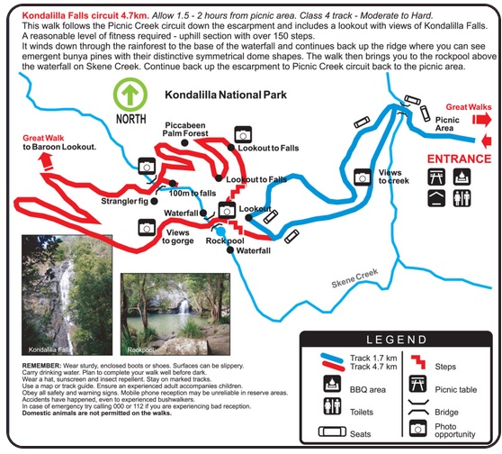
The Kondalilla Falls Circuit
This trail, (shown in red on the map) continues down from the Top of the falls and deep into the base of the valley below. Along the way you have great views of the falls in places, before crossing the valley floor and starting the climb back up.
These are not gentle, level walking paths and in places it really is more like climbing down rather than walking down. It is a strenuous walk for able bodied walkers and will take an hour between leaving the rock pools at the top and getting back there for a well earned dip.
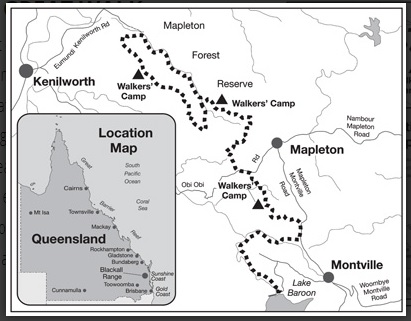
Sunshine Coast Hinterland Great Walk
From Maleny you join the Great Walk at its Southern end (where the Baroon Lookout Trial also starts).
To get there, take the Montville-Maleny road to Montville and as you enter the town turn left onto Western avenue.
Continue for 3 kilometres and turn left onto Narrows road.
After a steep decent continue for another 3-4 kilometres until you see the entrance to “The Great Walk” on your right.
This walk, can be broken down into smaller sections in some areas, with individual segments ranging from 1 hour to 7 hours. In most cases the sections are not circuits, so drop off and pick up at either end is required. You can download a map of entrance points here
The Great Walk totals 55 kilometres across the Blackall Range and the Maleny-Mapleton Plateau.
Along the way you pass through some rugged regions, and enjoy many natural wonders. There are creeks to cross, waterfalls, and native foliage including large Bunya Pines.
This walk requires careful planning and preparation. Along the way there are some specified camping areas, but permits are required before departure. There is also holiday accommodation along the way, with some venues providing a drop off/pick up service for walkers.
Be fully prepared and take everything you will need with you.
Once into the walk mobile phone reception is unreliable so plan carefully, and make sure someone knows when you expect to be at specific locations.
Visit www.nprsr.qld.gov.au for guidance on completing the great walk safely or call 13 74 68
So whether you want a leisurely stroll along the boardwalk, a walking tour of the Town, a half day outing or a serious multi-day trek, these Maleny Walks in and around the town, or in nearby Montville provide scenic options to suit.